Rongai Route | Climb Kilimanjaro From the Northern Side
Rongai is the only route that approaches Kilimanjaro from the north. It is known for gentle gradients, lower rainfall and fewer crowds, making it a popular choice in the rainy seasons and for climbers who want a quieter experience. After summiting via Gillman’s Point, climbers descend via the Marangu Route, seeing both the northern and southern sides of the mountain.
Plan a Rongai Route climb on Kilimanjaro. 6-day vs 7-day itineraries, Mawenzi Tarn, camps and altitudes, drier northern slopes, success rates, crowds, costs, best season and tips.
This guide explains the Rongai Route day by day, compares six- and seven-day versions, and covers difficulty, scenery, costs, seasons and who will enjoy this northern approach most.
Rongai Route at a Glance
| Feature | Details |
| Start | Nale Moru, about 1,950 m, northern slopes |
| Finish | Marangu Gate, about 1,860 m |
| Duration | 6 or 7 days |
| Distance | About 75 km |
| Accommodation | Tents |
| Summit approach | Kibo Hut or School Hut to Gillman’s Point and Uhuru Peak |
| Highlights | Northern wilderness, Mawenzi Tarn, views of Kenya |
| Crowds | Quiet |
Rongai Route Itinerary: 7 Days
| Day | Route | Altitude | Distance | Time |
| 1 | Nale Moru to Simba Camp | 1,950 to 2,600 m | About 7 km | 3 to 4 hours |
| 2 | Simba Camp to Second Cave | 2,600 to 3,450 m | About 6 km | 3 to 4 hours |
| 3 | Second Cave to Kikelewa Camp | 3,450 to 3,600 m | About 6 km | 3 to 4 hours |
| 4 | Kikelewa Camp to Mawenzi Tarn | 3,600 to 4,330 m | About 4 km | 3 to 4 hours |
| 5 | Mawenzi Tarn to Kibo Hut or School Hut | 4,330 to about 4,720 m | About 9 km | 4 to 5 hours |
| 6 | Summit via Gillman’s Point to Uhuru Peak, descend to Horombo Hut | 4,720 to 5,895 to 3,720 m | About 21 km | 11 to 15 hours |
| 7 | Horombo Hut to Marangu Gate | 3,720 to 1,860 m | About 20 km | 5 to 7 hours |
Day 1: Nale Moru to Simba Camp
After a drive around the mountain to the northern trailhead, you walk through farmland and pine plantations before entering forest. The northern forest is drier than the southern slopes. Simba Camp sits on the edge of the moorland.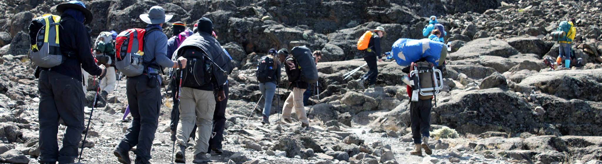
Day 2: Simba Camp to Second Cave
The trail climbs steadily through heath and moorland, with views of Kibo and Mawenzi. Second Cave camp lies near rock shelters.
Day 3: Second Cave to Kikelewa Camp
A shorter day crosses moorland towards Mawenzi. Kikelewa Camp offers views of the plains below.
Day 4: Kikelewa Camp to Mawenzi Tarn
The trail climbs to Mawenzi Tarn, a small lake beneath the jagged spires of Mawenzi. This is one of the most scenic camps on Kilimanjaro. An afternoon acclimatisation walk is often included.
Day 5: Mawenzi Tarn to Kibo Hut or School Hut
You cross the alpine desert saddle between Mawenzi and Kibo to the high camp, either Kibo Hut or School Hut, depending on the itinerary.
Day 6: Summit night and descent
You start climbing around midnight, reaching Gillman’s Point on the crater rim by dawn, then continue to Uhuru Peak. After the summit, you descend to Horombo Hut on the Marangu Route.
Day 7: Horombo Hut to Marangu Gate
The final descent passes through moorland and rainforest to Marangu Gate.
Rongai Route: 6 Days vs 7 Days
| Factor | 6 days | 7 days |
| Acclimatisation | Moderate | Better, with Mawenzi Tarn stay |
| Success rate | Moderate | Higher |
| Mawenzi Tarn camp | Often skipped | Included |
| Recommended for | Pre-acclimatised climbers | Most climbers |
Why Choose the Northern Side?
Drier conditions. The northern slopes receive less rainfall, making Rongai a good choice in the wet seasons.
Quieter trails. Fewer climbers mean a more peaceful experience.
Gentle gradients. The ascent is steady, without steep scrambles.
Unique views. Views towards Kenya and the Amboseli plains, plus close-up views of Mawenzi.
Two sides of the mountain. Ascend from the north and descend via the south.
Scenery Highlights
| Highlight | Description |
| Northern forest | Drier, quieter forest with pine plantations on the lower slopes |
| Moorland | Open views towards Kenya |
| Mawenzi Tarn | Small lake beneath Mawenzi’s spires |
| The Saddle | Lunar landscape between Mawenzi and Kibo |
| Gillman’s Point | Crater rim with sunrise views |
| Marangu descent | Rainforest and Horombo views |
Wildlife on the Rongai Route
The northern forest occasionally offers sightings of colobus monkeys and, rarely, larger animals such as buffalo or elephants in the lower areas. Birdlife is varied, with sunbirds and raptors in the moorland.
Route Closures
In early October 2026, the Rongai Route was briefly restricted as part of wildfire management on Kilimanjaro before reopening on 8 October. Such closures are rare and temporary, and operators reroute climbers if needed.
Costs
| Item | Approx. cost |
| Park fees for 7 days | Around US$1,000 or more including VAT |
| Mid-range 7-day package | US$2,700 to 4,000 per person |
| Extra transfer to the north | Often included; check with operator |
| Tips | US$250 to 400 per climber |
Best Time to Climb the Rongai Route
| Months | Conditions |
| January to early March | Dry, clear |
| April to May | Long rains, but drier than southern routes |
| June to October | Dry, colder |
| November | Short rains; Rongai is a good choice |
| December | Good |
Rongai is one of the best routes for climbing in the rainy seasons.
Rongai Compared With Marangu and Machame
| Factor | Rongai | Marangu | Machame |
| Start | North | Southeast | South |
| Accommodation | Tents | Huts | Tents |
| Crowds | Quiet | Moderate | Busy |
| Rainfall | Lower | Higher | Higher |
| Scenery | Good, wilderness feel | Good | Excellent |
| Descent | Marangu | Marangu | Mweka |
Mawenzi Tarn: Rongai’s Highlight
Mawenzi Tarn is one of the most beautiful camps on Kilimanjaro. Set at around 4,330 metres beneath the jagged spires of Mawenzi, it feels remote and dramatic. On clear afternoons, the light on Mawenzi’s cliffs is spectacular, and nights are cold and starry. An acclimatisation hike towards Mawenzi’s ridges helps your body adapt and offers views back across the northern plains.
Seven-day Rongai itineraries usually include a night at Mawenzi Tarn, which is one of the main reasons to choose the longer version.
The Northern Wilderness
Rongai’s early days pass through landscapes few Kilimanjaro climbers see. Pine plantations give way to natural forest and then to wide moorland. The northern slopes feel open and remote, with views over the plains of Kenya and the Amboseli area. Wildlife sightings are occasional, but the sense of space is a highlight in itself.
The drier climate on the northern side means trails are often firmer and less muddy than on the southern routes, especially in the wet seasons.
Summit Night From the North
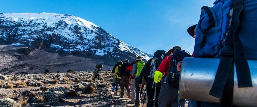
Rongai climbers usually summit via Gillman’s Point, the same approach used by Marangu climbers. The climb from Kibo Hut or School Hut is steep, with switchbacks up loose scree. Reaching Gillman’s Point at dawn offers views over Mawenzi and the plains. From there, it is about one and a half to two hours along the crater rim to Uhuru Peak, passing Stella Point and views of the glaciers.
The Marangu Descent
After summiting, Rongai climbers descend via the Marangu Route, staying at Horombo Hut. This means you see both sides of the mountain: the quiet northern wilderness on the way up and the more familiar southern slopes on the way down. The Marangu descent is long but gradual, passing through moorland and rainforest to Marangu Gate.
Who Should Choose Rongai?
Rongai suits climbers who want a quieter, gentler route, those climbing in the wet seasons and those who appreciate wilderness and space. It is a good option for first-time climbers who prefer steady gradients without scrambles like the Barranco Wall. Climbers seeking dramatic southern scenery may prefer Lemosho or Machame, but Rongai offers its own quiet rewards.
Expert Perspective
Guides who work regularly on Rongai often say it is the route where climbers relax most. The quiet trails, steady gradients and open landscapes create a calm atmosphere. Many climbers who chose Rongai for its practicality, such as drier weather, end up loving it for its peace and sense of space.
A Note on Rongai’s Gentle Gradients
Rongai is often described as gentle, and for most of the route that is true. The daily walking distances are moderate, and the gradients are steady rather than steep. This makes it easier on the legs and helps climbers maintain a slow, sustainable pace. However, gentleness does not remove the challenge of altitude. Climbers still need to walk slowly, drink plenty of water and listen to their bodies. Summit night, from Kibo Hut or School Hut to Gillman’s Point, is as steep and cold as on any route.
Seasonal Advantages in Detail
During the long rains of April and May, southern routes can be very wet, with muddy trails and frequent storms. The northern side, sheltered from moist ocean winds, often receives less rain. While Rongai is not completely dry in these months, many climbers find conditions more manageable. In the short rains of November, Rongai again offers an advantage. This is why many operators recommend Rongai to clients who must climb during the wetter months.
Final Week Before Your Climb
The last week before a Kilimanjaro climb matters more than many people realise. Reduce training intensity so your legs are fresh. Prioritise sleep, eat well and avoid illness by washing hands often while travelling. Arrive in Moshi or Arusha at least a day before the climb, ideally two, to recover from flights and adjust to the climate. Use this time to attend your operator’s briefing, check rental gear, pack your duffel within the weight limit and organise your daypack for the first day. A calm, rested start sets the tone for the whole climb.
Frequently Asked Questions About the Rongai Route
Is Rongai easier than Machame?
It has gentler gradients and no Barranco Wall, but summit night remains challenging.
Is Rongai less crowded?
Yes. It is one of the quietest routes on Kilimanjaro.
Is Rongai good in the rainy season?
Yes. The northern slopes are drier than the southern routes.
How long is the Rongai Route?
Six or seven days, covering about 75 kilometres.
Where does Rongai descend?
Via the Marangu Route on the southeastern side.
What is the success rate on Rongai?
Seven-day climbs generally have good success rates.
How far is the drive to the Rongai trailhead?
Usually three to four hours from Moshi, depending on road conditions.
Do I need a visa for Kenya?
No. Rongai starts in Tanzania near the border; you do not enter Kenya.
Is Rongai good for first-timers?
Yes. Its gentle gradients and quiet trails suit first-time climbers, especially on seven days.
Is there water on Rongai?
Yes. Crews collect water from streams and springs and treat it before drinking.
Can I see Kilimanjaro’s glaciers on Rongai?
Yes, especially on summit night and along the crater rim towards Uhuru Peak.